Rio das Velhas 3D Modelling - Brazil
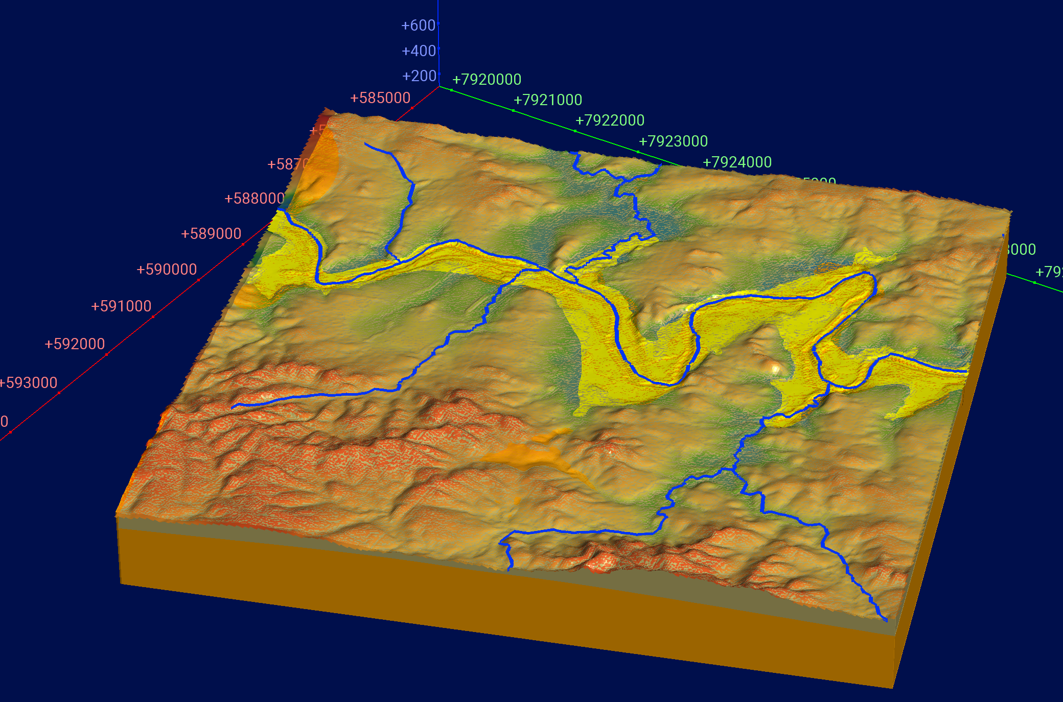
The 3D modeling is an integral part of the Conceptual Proposal for the Implementation of the Rio das Velhas Groundwater Program - This initiative constitutes the sixth deliverable of the broader "Proposal for the Classification of Surface Water Bodies and the Conceptual Proposal for the Implementation of a Groundwater Monitoring Program in the Rio das Velhas Basin and the Jequitaí-Pacuí River Basin." The creation of the 3D models serves two primary objectives. First, to enhance the understanding of the region's geology, particularly the alluvial deposits, which represent the most significant lithology due to their role in housing aquifers. Second, to establish a conceptual hydrogeological model, which will be a key deliverable of the project.
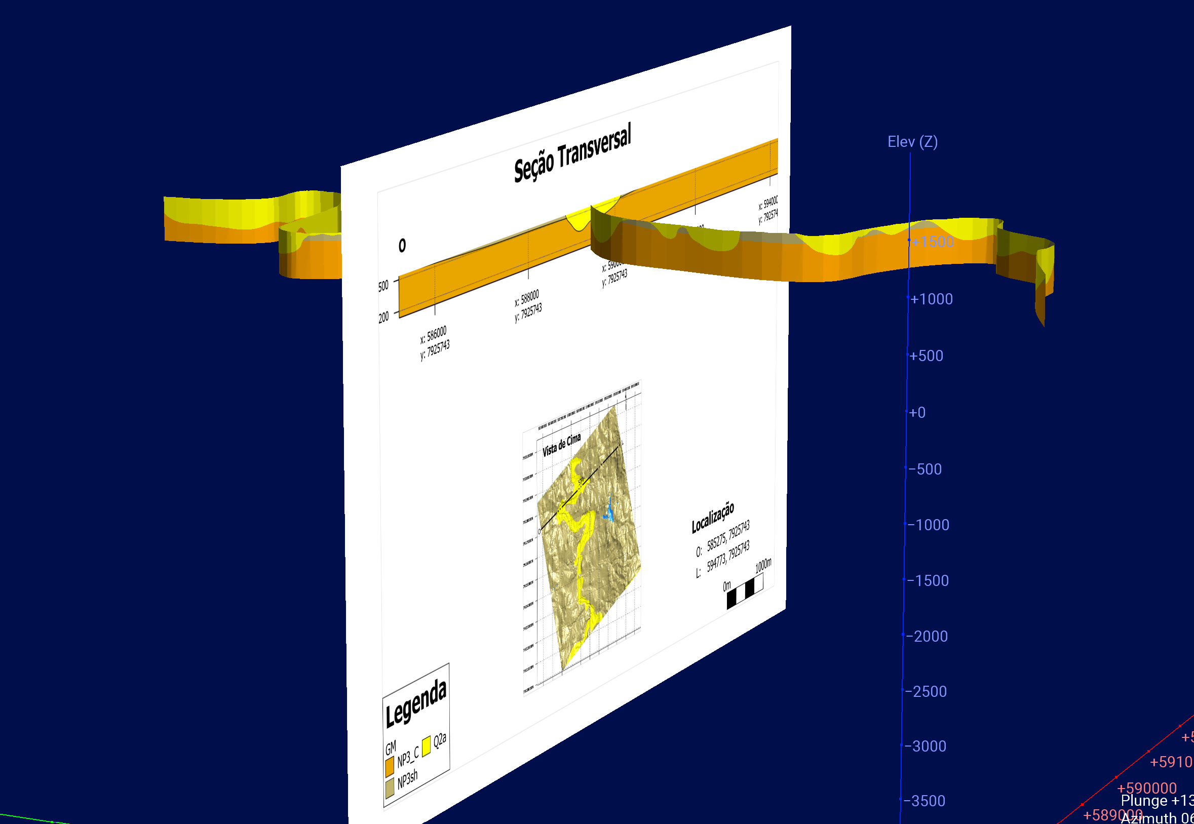
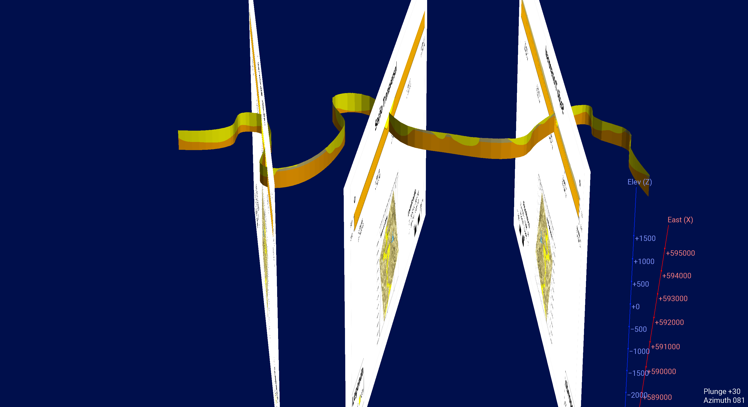
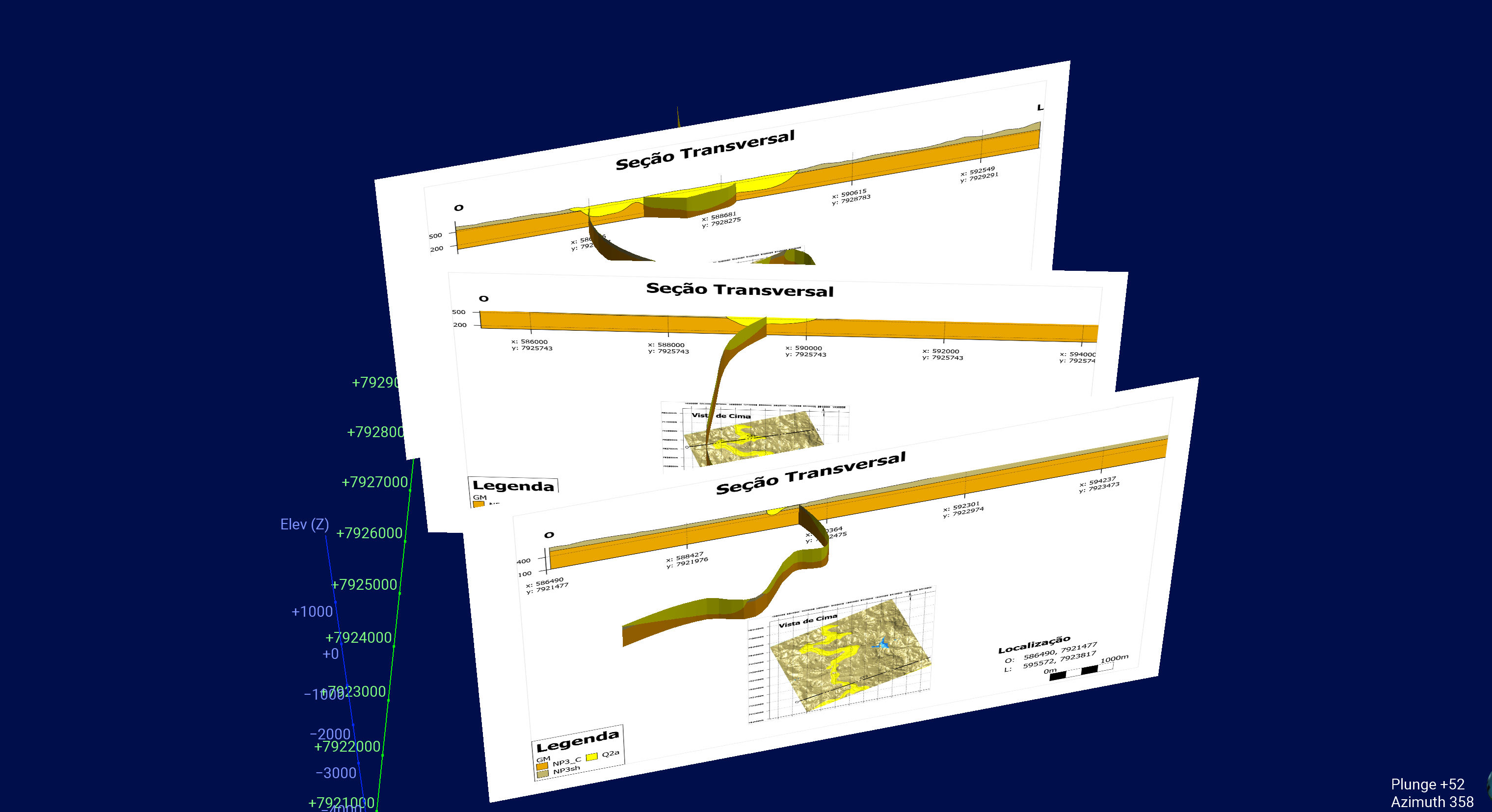
Numerous 3D georeferenced sections have been developed, offering various perspectives. Additionally, dynamic views have been generated, enabling users to visualize customized cuts that facilitate the measurement of the width and extent of lithologies. Furthermore, the volume of these lithologies can be calculated with a high degree of precision.
The hydrostratigraphic compartmentalization of the basin considered the predominant type of porosity, resulted in the following hydrogeological domains:
Aquifer Systems
- Granular: Alluvium and colluvial covers, as well as other stratigraphic units with sandstones and conglomerates. Groundwater flow occurs through intergranular porous spaces.
- Fissure-granular: Units with primary intergranular porosity but with significant secondary fissure porosity, such as quartzitic rocks
- Fissure: Stratigraphic units with predominant secondary porosity, such as igneous, metavolcanic, and metasedimentary rocks. Groundwater flow is predominantly through fissures.
- Karstic: Units predominantly consisting of carbonate rocks, characterized by a high rate of surface recharge and rapid circulation of groundwater. However, when overlain by Cenozoic sedimentary covers, recharge is controlled by the porous surface cover.
- Karstic-fissure: Units with intercalations of carbonate rocks, siltstones, shales, and phyllites, where lateral flow is restricted due to less permeable rocks. Recharge is predominantly vertical, and karstic dissolution is not as intense as in typically karstic aquifers.
|
|---|
|
|---|
|
|---|

|
|---|
An interactive 3D scene has been created for this model. To visualise it, you'll need a Seequent Viewer, a free desktop application. With Seequent viewer you can:
- Open and interact with the model
- Customize the display of the model and data
- Create slices and take measurements within the 3D scene